Join Zoom Meeting: https://us02web.zoom.us/j/89187002517?pwd=Ujc1UTEyVjNNbDhUUFJYMjFCV2lNdz09
Meeting ID: 891 8700 2517, Passcode: 212786
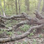
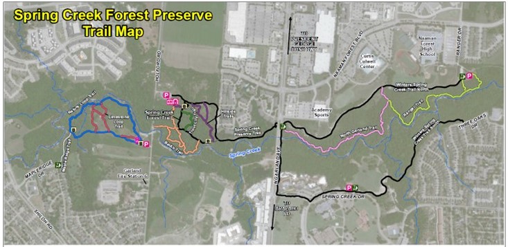
In November 2020, the Society sought volunteers to help map the park trails. David Parrish took the lead, collecting GPS points along most of the trail network; while Tina Rust, a Texas Master Naturalist and GIS analyst, then utilized these points in ArcGIS to begin creating a map for park visitors. Subsequent site visits were conducted to gather and incorporate landmarks such as picnic tables, benches, and parking areas. Through collaborative editing sessions with Dana Wilson and Society members, a full-color trail map was developed and added to the website. Go to our website, springcreekforest.org, Maps page, to see the result.
Tina and David will share their insights on the trail mapping process at Spring Creek Forest Preserve and offer valuable ideas that can be adopted by other parks. Tina will also lead our 4th Sunday walk at Spring Creek Park Preserve, 1787 Holford Rd, on Sunday, March 24.
Tina, a certified GIS Professional, Archaeologist, and Texas Master Naturalist, possesses a deep passion for merging her expertise in fieldwork, mapping, and databases. This passion found a perfect outlet in the project of mapping nature trails at Spring Creek Preserve. She is dedicated to nurturing a shared love for nature and committed to ensuring that others also find the same joy and fulfillment in connecting with the natural world.
Note: Also on March 5, Society Members that attend the Zoom meeting will vote on incoming Executive Committee members.