
Fixed Point Photography Stations for Environmental Analysis
Scout – Andrew Owen, Troop 57-B, Garland
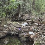
Fixed Point Photography Stations provide photographic images of a single point in the landscape to observe the change of the environment over time – changes such as receding riverbanks, wildflower fields through the seasons, or tree lines pushing into the prairie. Images can be used to create time lapse videos and analyze changes to the landscape.
Andrew planned and supervised the installation of three photo stations on Saturday, November 21, 2025. At each station, you can put your camera phone on the prop horizontally, take your photo, and then load it to the Society site using the QR code on the post.
He recruited help from Scouts, the Garland Parks and Recreation Department, and our own Society experts. There are two locations at 1770 Holford, the Bluebird Prairie and Creek View stations, and one at 1787 Holford, the Limestone Prairie station.
The project also included creating the underlying software system used to collect, store, and process the crowdsourced photos so they can be incorporated into a timelapse video for temporal analysis. Photos you take using the stations can now be uploaded to the Society site. Final computer coding will be complete, tested, and operational soon so you can see the photos on the Society website.
Many thanks to Jay Jascott and the other staff at the Garland parks department for digging holes in the difficult terrain. Jay mentioned that this project is not only fun and informative for our Preserve friends, it enhances the Garland Parks Department geospatial assets.
Notes: Each image will be reviewed for approved content, so there may be a few days delay before posting. All images submitted to the fixed point photo collection site are submitted free of copyright, claim, or other reservation, and are explicitly granted by the photographer to be used for educational and data collection purposes on the site.